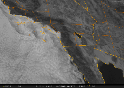
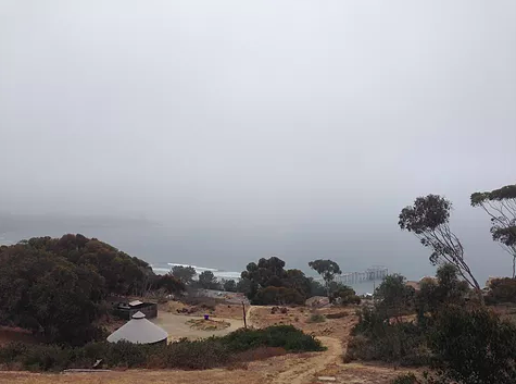
Dr. Rachel Clemesha, a research affiliate of the Center for Climate Change Impacts and Adaptation and project scientist at Scripps’ Climate, Atmospheric Science and Physical Oceanography (CASPO) division, created an interactive website that allows anyone to learn more about the clouds over their heads and share the results with others. Users upload a photo from their location directly to the Coast Clouds website, where it is then matched with a Satellite view using GPS data.
Upload your cloudy-day photos here.
Learn more about the Dr. Clemesha and other research affiliates here.
From below:
From above: