This week we’re highlighting center postdoc Julia Fiedler. Julia has a PhD and MS in Physical Oceanography from Scripps Institution of Oceanography, a BS in Global Environmental Science from the University of Hawaii at Manoa, and a BA in Fine Art from Yale University, 2003.
What climate change-related research projects are you working on currently?
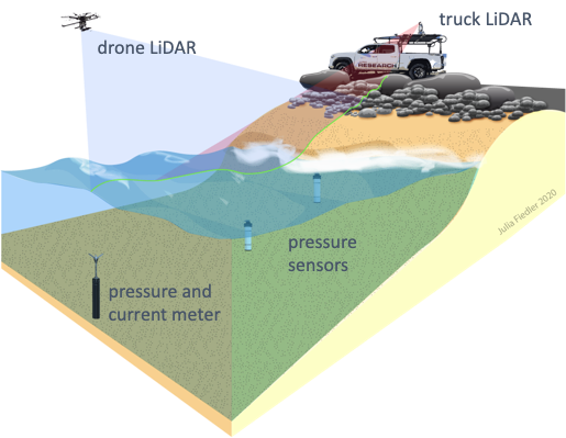
My research mainly focuses on something called wave run-up, or how high a wave can reach on a shoreline. To understand run-up, I use computer models to predict how waves will move through the surfzone and onto the beach, and I validate these predictions using observations from the field. For example, observations in the form of light detection and ranging measurements — or LiDAR — uses laser light to measure changing distances on the beach. These wave run-up models help us predict coastal flooding, both in Southern California and Hawaii.

What did you learn from studying IB about how beaches change during a storm?
This study really emphasizes the influence of the beach face on the components of coastal flooding – wave setup and swash, or the layer of water that washes up on the beach once a wave has broken. The tide level can greatly influence what the waves will do – here a steeper beach leads to larger, high-frequency swash (or waves rushing up and down at 4-25 second intervals). This is generally known in the literature and perhaps to the regular beach goer, but what we observed during the storm really emphasizes how quickly a beach can change in conjunction with the tide. This proves that having real life observations as a basis and validation for these models is really important.

How do recent coastal flooding events inform your model?
Validation is, and always should be, a major part of getting this kind of thing right. Getting these observations of flooding is really what will make this model robust, because it helps us understand where the errors are coming from – is it the wave predictions? The beach profile? The tide? The model itself? Our group is in the process of trying to pin these errors down.
What does a typical workday look like for you?
I typically do most of my work on the computer (using matlab for data and model analysis). Sometimes I get to go out into the field, which is probably my favorite part of science, because it involves being at the beach! On a typical pre-pandemic workday, I’d wake up before the kids got up to get some quiet computer work done. I’d then head into the office after dropping my twins off at daycare. Occasional seminars and meetings aside, I’d pretty much spend most of my time working on and running model codes, making data figures, talking to folks in our group, reading, and writing. After leaving to pick up the kids. I’d return to computer work or reading after the kids were in bed, around 8pm, if needed. These days, with daycare closed, I really miss my old work routine and those blissful, uninterrupted hours! That being said, I’m learning how to be more efficient with the limited time I have.
How did you get interested in your specific topic, or in science in general?
Back in Hawaii, where I was born and raised, I got really into canoe paddling. While I’ve always enjoyed being at the beach and swimming, it was the paddling that got me into physical oceanography. We were doing races in between the islands, and I wanted to understand how the currents and tides could give us an extra “push.” I basically wanted to get faster without actually paddling harder – story of my life! I checked out a book from the library on the currents around the islands. Later, I took a class at UH Manoa – Oceanography 101. It was that class that really opened my eyes. How do waves work? How does the Earth work? I went back and got another degree in Global Environmental Science at UH, taking classes in geology, math, and oceanography (and others!) I had an absolutely fantastic time there, and had very caring mentors that led me to my current path.
What aspect of your research helps us better understand or adapt to climate change?
A big part of my research is based in observations and validation, which allows for continual refinement of our predictions. Understanding how waves evolve in the surf zone is not only important for immediate management responses for current flooding events, but helps us to plan for wave run-up in future sea level scenarios. This is especially important here on the West Coast of the mainland US, where many coastal flooding events are driven by distant Pacific storms.
What are some surprising things that people might not know about you?
I have two undergraduate degrees – the first was in Fine Art, specializing in painting. The second is in Global Environmental Science. When I get the time, I still really enjoy making art. These days it mostly translates into figures for papers or presentations, or drawings I do with my 2 year olds!
What climate change information or resources do you want people to be aware of that they may not already know about?
I really enjoy following the climate science and scicomm communities on twitter. I get a lot of climate-related information, recent journal articles, and news from those sources- oftentimes things that my Google Scholar alerts will miss! Because twitter is inherently a more casual form of communication, it humanizes the scientists and writers behind the tweets. Twitter handles from news orgs and government agencies are also helpful for condensing sometimes lengthier reads. A few handles to get started: @NASAClimate, @iamscicomm, @nytclimate.
Thanks for sharing, Julia!
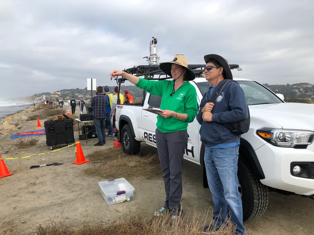
Featured photo shows Julia Fiedler and center Director Mark Merrifield, in the field at Torrey Pines State Beach.


