Resilient Futures: San Diego Bay
A wave and sea-level observation network
THE CHALLENGE
San Diego Bay is home to 15 military facilities, the Port, Airport and other valuable businesses, recreational assets and ecosystems. Developing site-specific predictions for high water events and sea-level rise is a key step in prioritizing and investing in adaptation strategies.
OUR APPROACH & PARTNERS
The project will develop a bay-wide observational network and model to enhance understanding of water level extremes, wave energy and potential flooding today and with increasing sea-level rise. Key support for this project is provided by San Diego Gas & Electric, the Port of San Diego, and the San Diego Airport Authority.
OUR APPROACH
The Center is taking a multi-faceted approach to enhance wave and flood forecasting, refine flood risk assessments and monitor changing conditions around San Diego Bay.
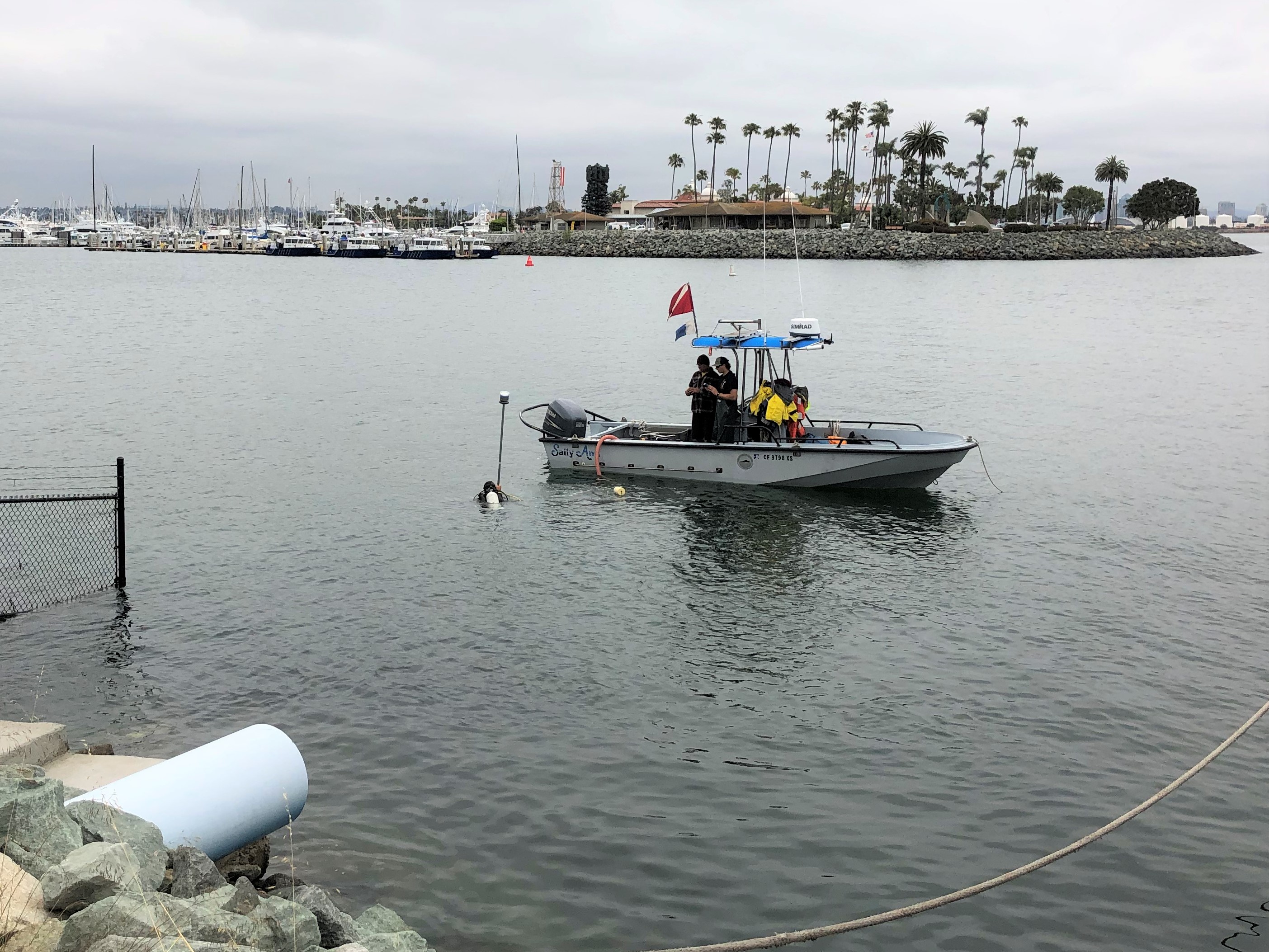 Wave-current pressure sensors located around the Bay will track wave energy from both offshore swell and wind-driven swell to determine how the Bay's water levels respond to wave energy combined with high tides. These sensors will also track energy from winter and summer storm surges to refine predictions of how increasing storm surge may result in flooding when combined with sea-level rise.
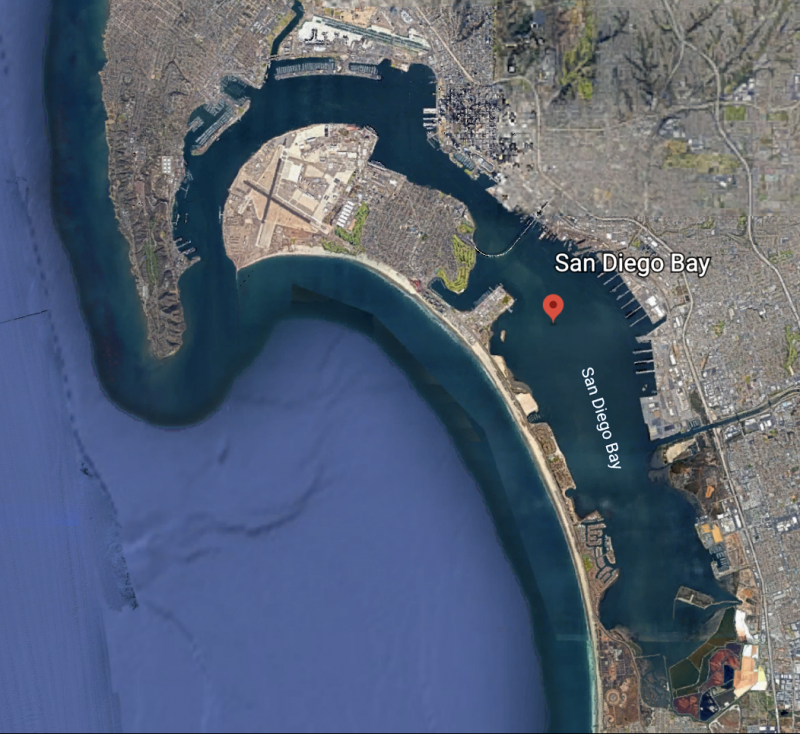 A comprehensive wave model specific to San Diego Bay is being created by combining an existing circulation model (developed by Scripps researchers) with offshore wave predictions and locally-generated wind waves forced by high resolution wind forcing. This model will serve as the foundation for developing a predictive tool to forecast water levels and identify events that could impact assets within the bay, directly informing shoreline protection and adaptation strategies.
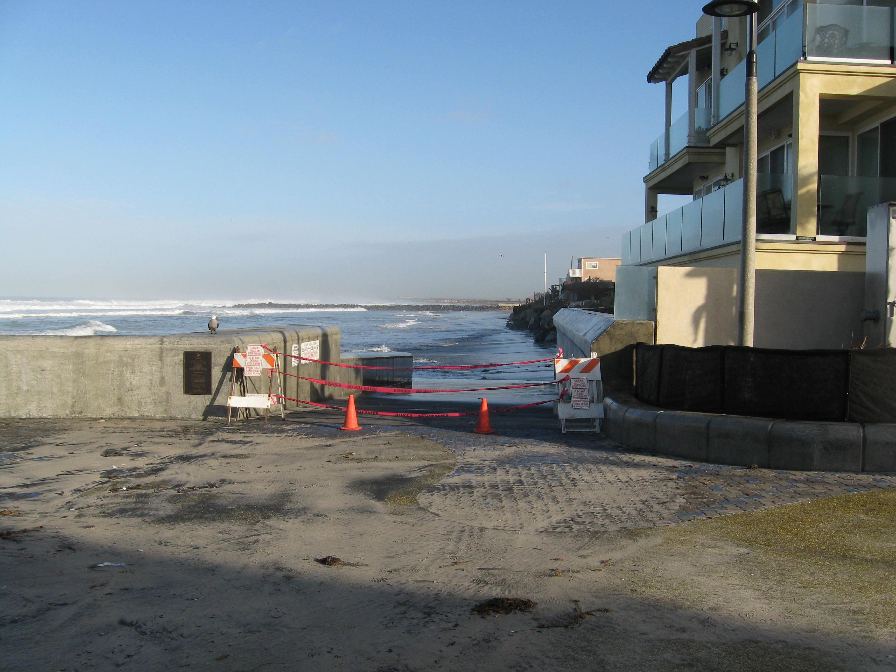 Coastal adaptation strategies along Silver Strand, the stretch of shoreline enclosing San Diego Bay, depend on the stability of protective beaches. Beach surveys are critical for assessing natural shoreline change, monitoring beach replenishments and erosion during El Nino waves, evaluating the stability of berms for shoreline protection, and tracking sediment buildup in estuaries.
 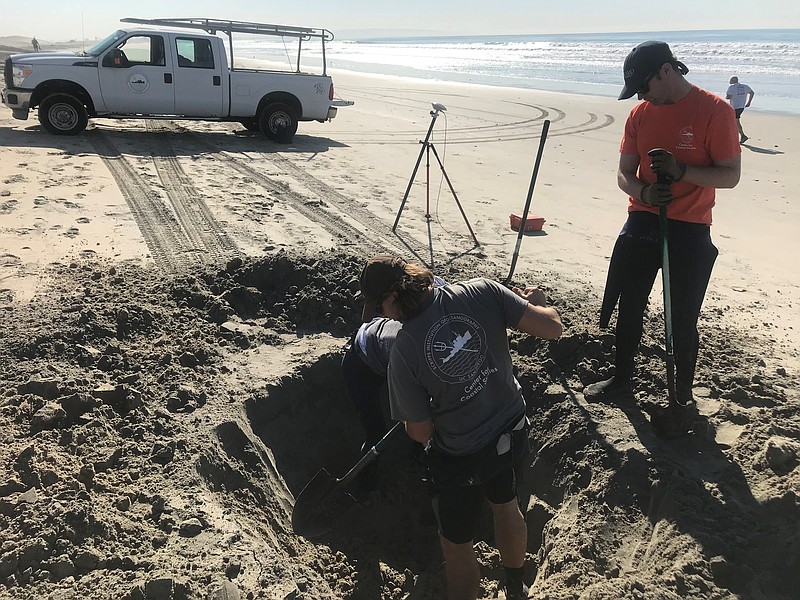 Dr. Sarah Giddings and Dr. Angelica Rodriguez have been researching San Diego Bay for a number of years. The initial hydrodynamic model showing how water moves in the Bay was developed by the Giddings and Feddersen groups (NSF and NADB/EPA funding) with the purpose of assessing pollution transport in the coastal ocean. The Giddings lab is currently engaged in a collaborative project with the Navy Marine Ecological Consortium collecting observations to enhance understanding of San Diego Bay environmental conditions and circulation patterns, allowing for better stewardship of the bay resources. Click
 Project Partners